
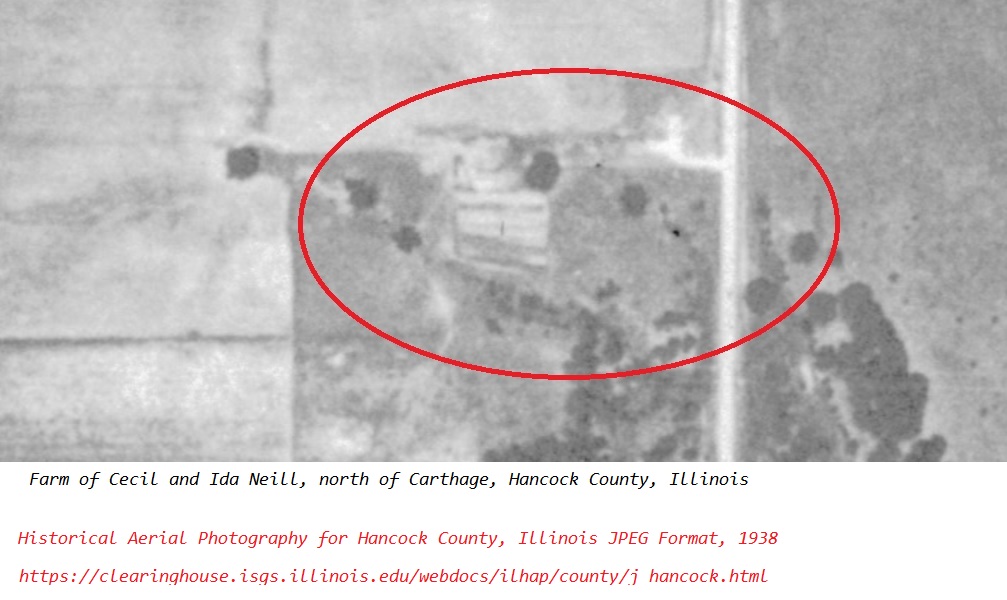
It took some doing to find this 1938 aerial photograph of my grandparents’ farm in Hancock County, Illinois.
The original images are located at the University of Illinois Map and Geography Library (https://clearinghouse.isgs.illinois.edu/webdocs/ilhap/county/). That web page was located via a Google search for historical aerial photographs of Hancock County, Illinois.
When using the overview of all the images for Hancock County, it was necessary to either know the geography of the county very well or have a map for reference. The images were in a countywide grid and it took some doing to find the location of interest. My grandparents lived on the highway a few miles north of the county seat. Their farm was located by finding the county seat on the digital images and following the highway north. It helped to be familiar with the local area and to keep in mind that the photographs were taken in 1938–not 2021.
The subdivision across from my grandparents’ home was not there in 1938. The railroad tracks that bordered the west end of my grandparents’ property were not abandoned and overgrown with brush in 1938. The images are not perfect as aerial photography was somewhat in its infancy in 1938 compared to today’s standards.


No responses yet