I’m not a big fan of “genealogical activities” that fall into my definition of cutesy or time-wasting. I realize others may have different points of view and that’s their opinion.
Activities that have a purpose or cause me to analyze my materials in more details are always good. Creating maps, charts, and other visuals can often help in solving problems or in making discoveries or realizations that one never expected to make.
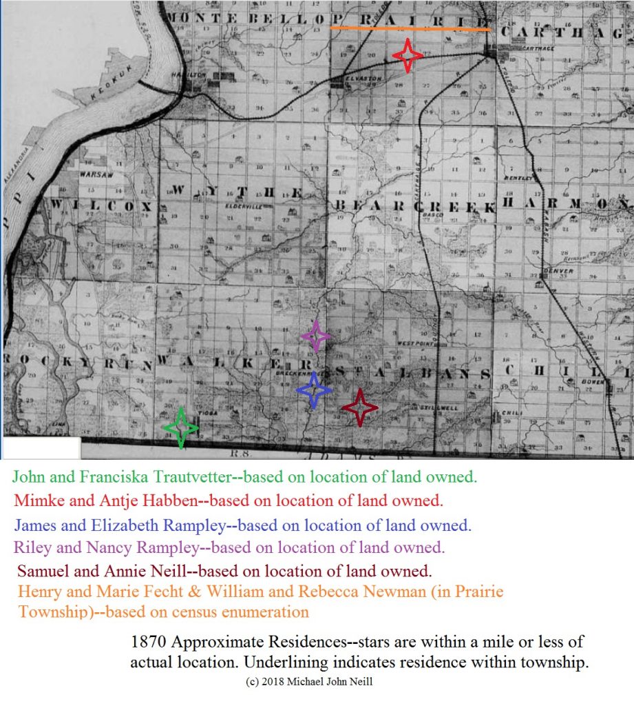
This map shows the approximate residential locations of fourteen of my adult ancestors who were living in 1870 in Hancock County, Illinois.

Approximate 1870 Residences of my Hancock County, Illinois ancestors–showing the general southwestern portion of the county.
I’ve always known these locations, but the map helps to visualize them in a little different perspective. It was somewhat of a challenge as I needed to review land records for those couples who were landowners to determine where their properties were located. The chart also included a reason for why each marker was placed where it was. None of my relatives during this time period were absentee landowners–all lived on their properties. Two families were not landowners during this time period and their residence is only known as precisely as the township. I suspect that the Fecht family lived near the Habbens, but have no direct evidence to support that theory.
And I immediately noticed the following when the image was added to this post:
- I cut off part of Prairie Township–because I think both families lived in the southern half of that township. Assumptions can cause us to make subconscious editing decisions
- I left out Barbara Haase who was living in the town of Warsaw

2 Responses
My ancestors were is Hancock County at this time — I about fell over when I saw this map, which I recognized from poring over it for hours as I tried to figure out where my ancestors were. My Arnold family ancestors were in thw town of Hamilton in Montebello Township. My Ellefritz and Wilson ancestors were in Pilot Grove and Rock Creek Townships. My Botts ancestors were in St. Mary’s Township (my 4th great-grandfather, Joseph Botts, founding St. Mary’s Church in the town of Plymouth in St. Mary’s Township in 1857, when he served as its first pastor. His granddaughter, my 2nd great-grandmother Mary Botts Ellefritz, died in Carthage in 1913. I made a research trip to this part of Illinois in 2018. I was working on a project called “1900”, which was about where my ancestors were in that year. My fathers paternal and maternal ancestors were in Hancock County. My mother’s paternal ancestors were in Guthrie OK, where they had procured land during the 1889 Oklahoma Land Run. My mother’s maternal ancestors were in Lee County, Texas. I went to all three locations and had a blast. I loved finding the land records in Nauvoo; the records were about just one county — Hancock — and just during the time the Mormons were there — 1840-1846 or so. But that was exactly when my ancestors were moving there, and the records were for the entire county — so-called “gentiles” as well as Mormons. My ancestors were gentiles but I was able to pinpoint where they lived.
I have never used maps like this. What an interesting thing to do and one I shall attempt. Thank you.