Visit: http://historicalmaps.arcgis.com/usgs/
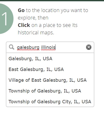
Type in the name of a location in the “find a place” box and pull down the appropriate place from the drop-down menu. Your map on the main part of your screen should then be centered on that location.
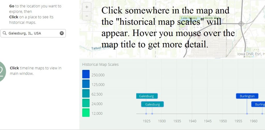
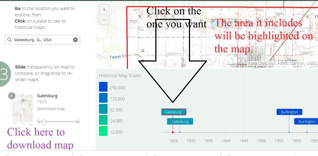
Click somewhere in the map that just appeared and you will get a timeline of the maps that are available that include the location where you clicked your mouse. You can click on the map’s title to see it highlighted in the background.
You’ll also get an option to download the map as a PDF file. Neat stuff.


No responses yet